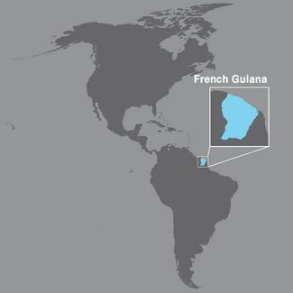
Guadeloupe, French Guiana, and Martinique are French Overseas Departments in the Americas and have been an integral part of France since 1946. The archipelago of Guadeloupe is the larger of the two island territories, with a land area of 1,703 km2. Martinique has 1,128 km2, and French Guiana, 83,534 km2.
Guadeloupe and Martinique enjoy a tropical climate and are often buffeted by tropical storms between July and October. French Guiana has an equatorial climate, and 95% of its territory is covered by dense Amazonian forest. In 2015, the populations of Guadeloupe and Martinique were comparable in size (402,119 and 385,551, respectively), while that of French Guiana numbered 244,118.
In 2014, life expectancy at birth in Martinique was 83.9 years in women and 78.1 years in men; in Guadeloupe, it was 83.4 years and 76.1 years, respectively; while in French Guiana, it was 83.1 years and 76.7 years, respectively. Per capita gross domestic product (GDP) in 2015 was €22,571 in Martinique, €20,163 in Guadeloupe, and €16,645 in French Guiana.


