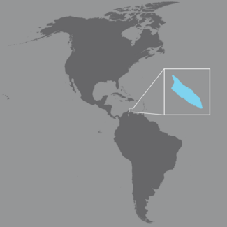
Aruba, an island with a landmass of 180 km2 and lying about 25 km off the coast of Venezuela in the Caribbean Sea, is an autonomous country within the Kingdom of the Netherlands. It was part of the Netherlands Antilles until 1986, when it became an autonomous country within the Kingdom of the Netherlands. The island is autonomous in terms of administration and management of public policies, but is under the authority of the Kingdom of Netherlands in areas such as defense, foreign affairs, and the administration of justice.
In 2014, Aruba had a population of 108,374. Between 1990 and 2015, the population grew by 67.2%. In 1990, its population pyramid was beginning to develop a stationary trend in people under 30. The population pyramid is currently exhibiting a regressive trend, with greater expansion in the working-age population. This structure is influenced by immigration, which is particularly concentrated in the working-age population.
In 2011, life expectancy at birth was 76.9 years (73.9 for men and 79.8 for women).
Tourism is the leading economic activity. In 2015, the country received 1.8 million tourists (66% stayed overnight and the rest came from cruise ships).
(Source: Health in the Americas+, 2017 Edition)
Aruba is served by the PAHO/WHO Country Office in Trinidad and Tobago.


